 |
Intro to Federal Census Research
Series: T626 (2,667 rolls) |
 |
Intro to Federal Census Research
Series: T626 (2,667 rolls) |
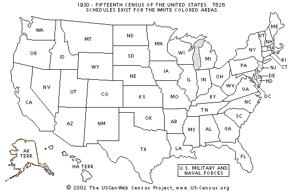
In the late 1930s, the Work Projects Administration (WPA) prepared the Soundex cards. When the WPA closed down in the early 1940s, no more Soundex indexes were created. The 1930 census has soundex cards for ten states in their entirety. In addition, there are Soundex indexes for the selected counties in Kentucky and West Virginia. ED numbers for institutions are listed at the end of the Soundex indexes for each state, except for Georgia, which does not include institutions.
* Only the following Kentucky counties are indexed: Bell, Floyd, Harlan, Kenton, Muhlenberg, Perry, and Pike. ** Only the following West Virginia counties are indexed: Fayette, Harrison, Kanawha, Logan, McDowell, Mercer, and Raleigh.
When the Bureau of the Census assigned areas for census takers to visit when collecting information from residents, it divided counties, cities, towns, villages, Indian reservations, and even hospitals and jails into enumeration districts (ED). Heavily populated areas like major cities would have dozens or even hundreds of EDs while rural counties and places would have only a few or one. Each county was assigned a number, and each ED within it was then numbered consecutively. When the census schedule sheets were compiled, they were arranged by state, county, city or township, and thereunder by ED number. They appear in this order on the microfilm.
For the 1930 census, the Bureau of the Census developed a new ED numbering system for 52 of the 56 jurisdictions. Within each state, each county has a distinct number that is followed by the specific enumeration district number. The county numbers were assigned based on the alphabetical order of the counties within each state. For example, Adams County, Washington, has EDs 1-1 to 1-22; Asotin has EDs 2-1 to 2-17; and Benton County has EDs 3-1 to 3-29. American Samoa, the Canal Zone, Guam, and the Virgin Islands, however, did not use this system.
The Bureau of the Census carefully recorded descriptions of each ED and had a consistent scheme for laying out and numbering Enumeration Districts in major cities and counties. The EDs were laid out and numbered in rows with the ED number in ascending order from west to east. In large cities, most descriptions included only the streets that bounded the district. Often the boundaries matched those of city wards or election precincts. ED descriptions did not include streets other than the boundary streets; i.e., interior streets were not listed.
In rural areas the description might include geographic features like rivers or hills or the names of villages, post offices, or Indian reservations.
Institutions such as hospitals, schools, jails, and orphan asylums were assigned enumeration districts.
Sometimes no one lived in an ED, in which case the enumerator wrote "no population" on the sheet. These EDs are noted by "NP" in the catalog. Some of the EDs contain as few as one person. Care must be taken when viewing the film in order to not miss these small EDs. In a few cases, the Bureau combined two EDs. The number that was not used is listed as "void."
The complete and original 1930 census enumeration districts descriptions are available as Microfilm publication number T1224, rolls 61 to 90.
The Bureau of the Census also used contemporary maps upon which it overlaid, often just with grease pencil notations, the boundaries and numbers of enumeration districts. The quality and visual clarity of the maps varied considerably. The complete set of these maps is available as National Archives Microfilm Publication M1930, Enumeration District Maps for the Fifteenth Census of the United States, 1930.
|

|
|
To
narrow your search results put Last Name first inside quotation marks.
EXAMPLE "Smith, John"